Leveraging Google Maps Property Lines for Real Estate Decisions
Remember the age-old advice on ‘measure twice, cut once’? It holds just as well in digital mapping as in carpentry. So, let’s kick off this journey with the basics of Google Maps property lines.
The Basics of Google Maps Property Lines
The development and function of property lines on Google Maps can be traced back to the service’s inception in 2005. Starting its journey as a basic mapping system, Google Maps quickly started allowing us to explore our world with just a few clicks. Fast forward to today, and you can view property lines if you type your address into Google Map’s search bar and zoom in closely enough. It’s a fascinating trait for keen eyes going through satellite images for property outline. However, I’ll add, don’t count it as gospel. Google Maps isn’t always accurate for property lines as it’s designed to provide general guidance.
Google Maps’ property lines accuracy and regular updates are paramount to real estate stakeholders. Having up-to-date and precise property lines allows them to make informed decisions about properties. Remember, however, more official records on property boundaries should supersede Google Maps when it comes to legal matters.
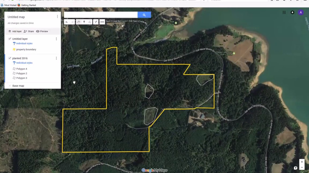
Harnessing the Power of Google Maps for Property Assessment
Understanding the boundary lines on Google Maps is as simple as typing in an address. Google Maps will show the approximate boundary of the property. Yet, this power should be used responsibly, considering the limitations of Google Maps in providing exact boundaries.
The interesting part is, a speedy loan could be your sidekick if you’ve laid your eyes on a property via Google Maps and decided to take the plunge. Google Maps can show you the property and the surrounding areas in-depth, helping you make a quick decision. A fast loan application subsequently could save you from missing out on your dream property.
Satellite Map That Shows Property Lines Free: An In-depth Analysis
There’s more to unravel when it comes to satellite images and property lines. Even the battle of free satellite maps versus premium services has insights worth understanding.

Exploring Satellite Imagery and Property Lines
Navigating through satellite images on Google Maps to identify property lines is easy. To get the details, you can toggle between the standard map view and the satellite images. This way, real estate buyers and sellers can glance at the property from a new perspective.
But remember, the satellite imagery of Google Maps can be a few years old at times. Thus, newer developments might not show up immediately on your screen. Despite these caveats, the convenience of exploring property from the comfort of your home always scores points.
Free Satellite Maps Versus Premium Services
Free satellite maps show property lines and allow you a virtual tour of the area. They offer an easy, user-friendly approach to provide visual data.
However, solely relying on them is as risky as putting all your eggs in one basket. Free platforms like Google Maps mainly offer a generic idea of property boundaries. For an in-depth revelation, premium Geographic Information System (GIS) services such as ARC GIS serve the purpose. Premium services delve deeper into property information, using recorded data from county auditor sites.

| Subject | Information | Details |
|---|---|---|
| Viewing Property Lines | Google Maps | Property lines may be visible when zooming into a specific address on Google Maps. This is not available globally in all locations. |
| Accuracy | Limited Accuracy | Google Maps does not guarantee the accuracy of property lines. It can give a general idea of property boundaries but should not be used as a definitive source. |
| Alternatives | Homesnap | Homesnap is a free application that shows property lines useful for homebuyers, sellers, or those looking to better understand a property. |
| Accuracy of Alternatives | Not Specified | The accuracy of Homesnap’s property lines has not been specified. Despite the accurate house evaluations shared on its services, it is always wise to cross-check information or consult with professional real estate agents or surveyors. |
| Utility | Real Estate Deals | These tools can aid understanding of property boundaries when buying or selling homes, but it’s essential to verify information from other sources as property lines have legal implications. |
| Price | Free | Both Google Maps and Homesnap offer services for viewing property lines for free. |
| Additional Notes | Not a Legal Document | Maps displaying property lines should not be used as a legal document, since they may not be accurate or up-to-date. When in doubt, consult a licensed land surveyor or other real estate professionals. |
How Campus Maps Use Property Lines: The Cases of UNM and UVM
Magellan’s navigation landed him on new continents, our digital exploration of campus maps might land us on the UNM campus map or UVM campus map. The use of property lines on campus maps like these is quite an interesting topic.
Understanding the UNM Campus Map
Campus boundaries and property lines at the University of New Mexico (UNM) are a clear testimony of well-designed campus mapping. Property lines affect things such as a campus’s growth, restructuring, and even students’ mileage rate 2024. For any campus construction or expansion, pertinent property boundaries need to be comprehended and honored.
Evaluating the UVM Campus Map
Taking the example of the University of Vermont (UVM), the property lines define the university footprint, playing a significant role in academic institutional planning. Like UNM, UVM requires an understanding of property lines for strategic planning purposes, whether for new buildings or other infrastructural developments.
Determining Your Residency: What State Do I Live In?
Ever had the conundrum of analogously asking yourself “what’s the Bought Vs Brought” but in terms of your living state lines? Here’s how Google Maps can help with that.
State Boundaries on Google Maps
Google Maps isn’t just about street names and cityscapes; it also displays state lines and boundaries. At the border areas, you might often find yourself asking, “what state do I live in?” Here, Google Maps comes to your rescue, showing the approximate state lines.
Beyond State Lines: Where Do You Live?
With Google Maps, you can pinpoint your exact location using property line info, whether you’re in the town center or the countryside. So, to answer “where do you live“, you might just need a quick glance at Google Maps. You’d be sure of your position faster than actor Theo James could solve a mystery in his film.

The Future of Google Maps Property Lines
With a world getting more connected every day and technology galloping at light’s speed, property lines in Google Maps hold a promising future.
Innovative Uses of Property Lines
Emerging trends and technology in property line mapping look set to redefine how we see property lines. From augmented reality to Artificial Intelligence (AI), technology will likely provide more accurate and interactive property line viewing. The use of property lines will also undoubtedly extend to several industries, from real estate to logistics and retail.
Final Reflections: Google Maps and Property Lines
In reflection, Google Maps property lines have come a long way since the early days. However, their basic function remains the same: to give a general idea of property boundary lines. This doesn’t seem likely to change, as these lines form the very foundation of land ownership.
Indeed, with further digital innovations on the horizon, it’s important to remember that Google Maps functions best as a complement to, rather than a substitute for, more precise land survey maps or legal property deeds. Yet, within these limits, they will undoubtedly continue to help us find our way—whether we’re deciding which plot to buy, finding a new route home, or simply answering our curious query of “Where Should I live“.
Is there a way to see property lines on Google Maps?
Woah, hold up! Google Maps isn’t really the go-to tool for checking out property lines as it’s not its specialty. For fine-tuned, property specific details, you’d be better off checking with your local county’s assessor’s office or a land surveyor.
Is there a free map app that shows property lines?
For a free app option, ‘LandGlide’ plays the part well. It shows property lines and is pretty easy to use, just keep in mind, it’s not infallible and you should cross-check with professional resources.
How accurate are the boundary lines on Google Maps?
About Google Maps boundary lines, let’s be real here, they aren’t a hundred percent spot-on all the time. They give you a general idea but for legal purposes, you’d need a pro survey.
How do I find property lines in Indiana?
In the Hoosier State, finding property lines isn’t a brain-buster! You can find them on the website of local County’s Assessor or Recorder’s office. A bit of online digging is all it needs!
How do I find local property lines?
For local property lines, save yourself the hassle and make a beeline for the county recorder’s office website. Remember, the local guys will have the most accurate, up-to-date info.
What is the best site for property lines?
Of all the websites out there, ‘Zillow’ takes the prize for best property line details. It’s user-friendly and packed with useful details, making it an ace choice for property hunters.
What is the best free property line app?
Hunting for the best free property line app? Give ‘LandGlide’ a whirl! It’s umpteen handy features make it the kingpin of property line apps.
Can I use my phone to find my property lines?
Yes siree, your mobile device can be your best buddy to find those elusive property lines. With the right app like ‘LandGlide’, you’ll have those boundaries at your fingertips in no time.
How accurate is LandGlide property lines?
Talking about ‘LandGlide’, it’s decently accurate for most needs. Still, for any sort of dispute or legal matter – don’t rely solely on the app. For that, you need a professional surveyor, buddy.
What map shows boundary lines?
Any map that shows official boundaries is labeled as a ‘political map’. This fella gives you an outline of countries, states, and smaller administrative regions.
Can you see fault lines on Google Earth?
Wowzers, yes! Google Earth lets you see fault lines. Just click on the ‘View’ tab, then ‘Sidebar’, and finally check the ‘Earthquakes’ box. Fascinating stuff, we tell ya!
Does a physical map show boundary lines True or false?
Hmm, just to clear any confusion, a ‘physical map’ won’t show you political boundaries. So, false is the answer there. It’s more about landforms and terrain rather than lines and limits.
Who owns the property next to me?
Now, about who owns the property next to yours? This is where the online public records from your local county’s assessor or recorder comes into play. Look up the address, and voila! You’ve got your answer.
How do I look up property deeds in Indiana?
Looking up property deeds in Indiana is a walk in the park. Just head to your local County Recorder’s website, and you should find an online portal for searching the land records. If this doesn’t work, ‘Indiana Land Records’ is the statewide service that may have what you’re looking for.
Who owns the land next to me?
The accuracy of LandGlide can be hit or miss. It’s usually good for a ballpark estimate, but if you need something legally binding, better get a professional surveyor.
How accurate is LandGlide?
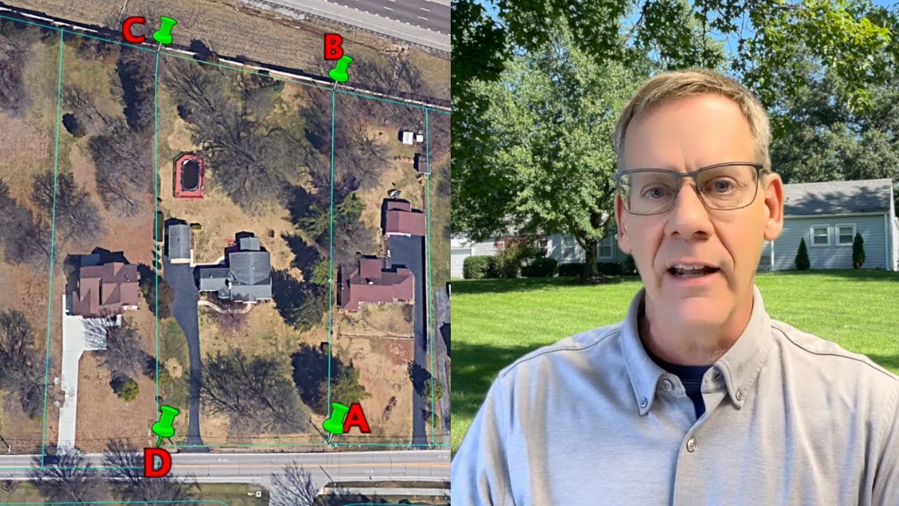
Outlining a property on Google Earth is doable. Use the ruler tool or the “Add Polygon” feature. Just remember, it’s meant for basic visualization, not official boundary mapping.
How do you outline a property on Google Earth?
In terms of marking a property on Google Earth, you’ve got options! You can drop a pin, for starters. Just right-click on your location of choice and click “Add Placemark.”
How do I mark a property on Google Earth?
For Google Maps, pinning your property is a no-brainer. Search or navigate to your location, click and hold to drop a pin, and you’re golden! Just remember, these are informal markers, not official property lines.